Has that ever happened before? That sounds like some once in forever kind of things.
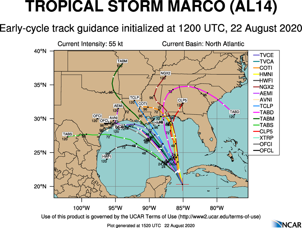
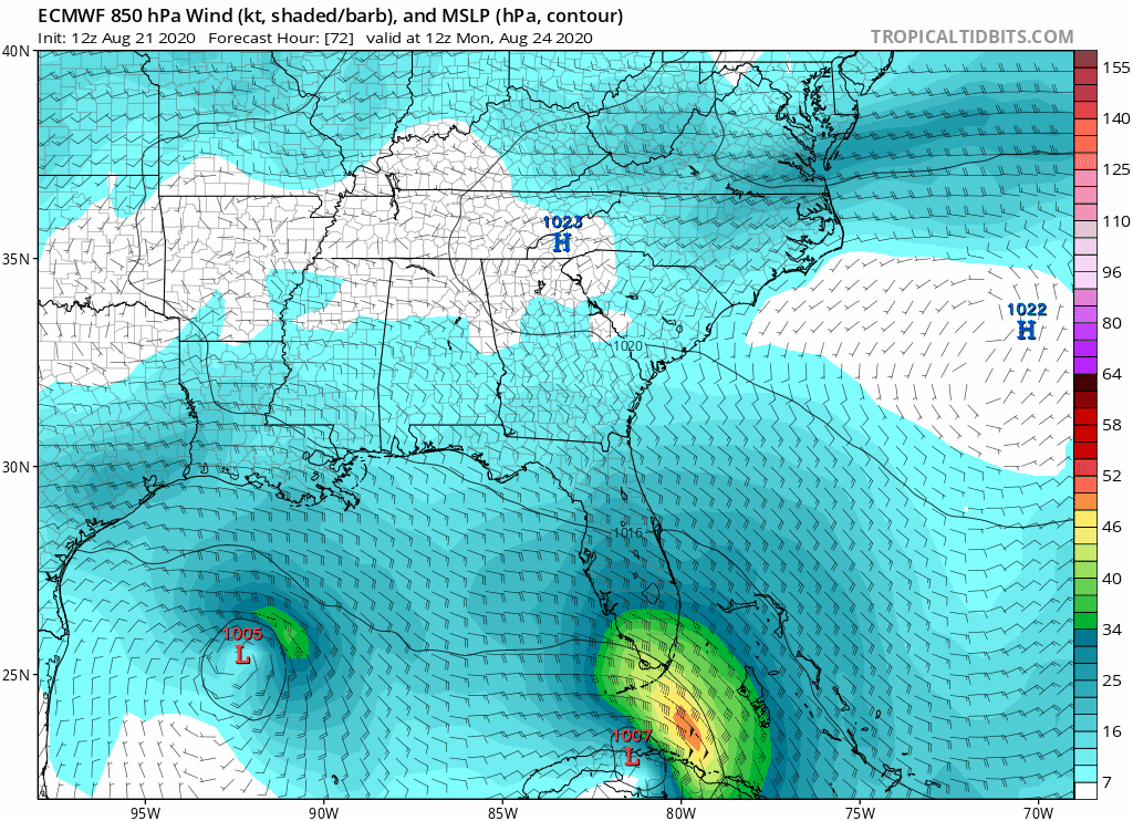
Storms getting close to each other and one absorbing each other isn't that rare. John and Ileana in 2018, Wilma and Alpha in 05, Iris and Karen in 95, storms rotating around each other is more rare.
and to be clear this is usually to a detrimental nominal effect to both storms, These storms getting close to each shouldn't be seen as some 2020 end of days things its not gonna create a supercane or something.